Trail Mountain bike Mont Lozère et Goulet - Chasserades Finiels 2020 - Photo

Chasserades Finiels 2020

© OpenStreetMap contributors
Length
Length
48 km
Max alt
Max alt
1672 m
Uphill gradient
Uphill gradient
1417 m
Km-Effort
Km-Effort  
67 km
Min alt
Min alt
1063 m
Downhill gradient
Downhill gradient
1364 m
Boucle
Boucle
No
Creation date :
2020-07-31 06:45:22.927
Updated on :
2020-08-09 07:00:48.38

(0 Reviews)

Mountain bike
Mountain bike
5h36
Difficulty : Difficult

Scan this QR Code to open this trail in the SityTrail application

FREE GPS app for hiking

Logo SityTrail SityTrail

IGN / Geographical institutes

Download SityTrail from the App Store Download SityTrail from Google Play

Logo SityTrail SityTrail World

The world is yours!

Download SityTrail from the App Store Download SityTrail from Google Play Download SityTrail on Huawei AppGallery

About

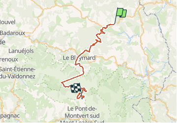
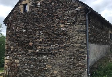
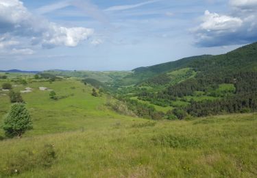
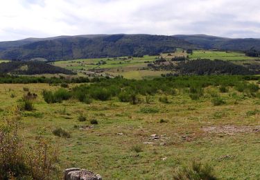
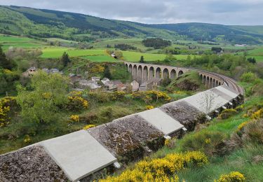
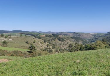
Trail Mountain bike of 48 km to be discovered at Occitania, Lozère, Mont Lozère et Goulet. This trail is proposed by JeanPierreNancy.

Description

Attention : Pb GPS après la station du Bleymard, on peut faire le tour en passant par le chemin des Chômeurs, ce qui offre de beaux paysages, compter 10 km  en plus)

Elevation profile

Photos

Positioning

Country:
France
Region :
Occitania
Department/Province :
Lozère
Municipality :
Mont Lozère et Goulet
Location:
Unknown
Start:(UTM)
566437 ; 4933660 (31T) N.

Trails nearby

Trail Walking Mont Lozère et Goulet - Stevenson étape 7 - Photo
Walking
GUIDE
nadinebondoux

Walking

Difficult
Mont Lozère et Goulet, Occitania, Lozère, France
20 km | 28 km-effort
4h 57min
No
Trail Walking Mont Lozère et Goulet - le Bleymard  - Photo
Walking
jeanjean35

Walking

Very difficult
Mont Lozère et Goulet, Occitania, Lozère, France
17.3 km | 25 km-effort
5h 14min
No
Trail Walking Mont Lozère et Goulet - Chasserades Bleymard  - Photo
Walking
GUIDE
Roger Philippe Wallez

Walking

Difficult
Mont Lozère et Goulet, Occitania, Lozère, France
20 km | 28 km-effort
6h 57min
No
Trail Walking Mont Lozère et Goulet - arsel chasserades au bleymard  - Photo
Walking
labarone

Walking

Very easy
Mont Lozère et Goulet, Occitania, Lozère, France
14.1 km | 21 km-effort
6h 14min
No
Trail Walking Mont Lozère et Goulet - Chasserades -Station Mont Lozère Stevenson - Photo
Walking
kephas

Walking

Difficult
(1)
Mont Lozère et Goulet, Occitania, Lozère, France
25 km | 37 km-effort
7h 47min
No
Trail Walking Mont Lozère et Goulet - GR_70_AG_07_Mont-Lozere-Goulet_Cubieres_20140921 - Photo
Walking
patrickdanilo

Walking

Very difficult
Mont Lozère et Goulet, Occitania, Lozère, France
19.8 km | 30 km-effort
6h 12min
No
Trail Walking Mont Lozère et Goulet - Stevenson Chasseradès - Le Bleymard - Photo
Walking
VANDERPUTTENMi

Walking

Very difficult
Mont Lozère et Goulet, Occitania, Lozère, France
21 km | 29 km-effort
5h 4min
No
Trail Walking Mont Lozère et Goulet - 20230405 Chasserades-le Bleymard - Photo
Walking
ThonyM

Walking

Easy
Mont Lozère et Goulet, Occitania, Lozère, France
18.7 km | 26 km-effort
4h 32min
No
Trail Horseback riding Mont Lozère et Goulet - 2022-09-19 Rando CVA Lozere Chasserades vers Refuge Mont Lozere - Photo
Horseback riding
GUIDE
holtzv

Horseback riding

Medium
Mont Lozère et Goulet, Occitania, Lozère, France
27 km | 40 km-effort
5h 46min
No


Close
My subscriptions